The Caucasus, a biogeographical gemstone
The Caucasus is widely accepted as a biodiversity hotspot: In
biogeography it is at the cross-road of the eastern and western
Eurasian mountains and where major climate provinces meet. But
what was the long-term dynamics of flora, vegetation, and climate?
Palaeoecology may answer such questions.
Map of Georgia: Geomorphology and vegetation
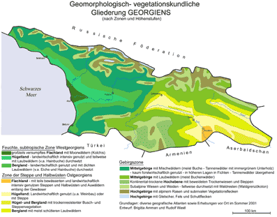
(designed by Dr. R. Wastl based on several Georgian maps.
Click on the map to see larger version)

The contrasts between the Great Caucasus and the Caucasus Minor
are very large concerning both the geology and the climate. These
contrasts can especially be observed in Georgia. This country has
the shape of a triangle, for the western side is the coast of the
Black Sea, the northern side is the Great Caucasus, and the southern
side is the Caucasus Minor. The Great Caucasus as an element of
the alpine orogenic belt (from the Pyrenees to the Himalaya) contains
the highest mountain of Europe, the Elbrus in Russia, (5633 m asl)
and the Kazbegi in Georgia (5044 m asl). The Caucasus Minor, in
contrast, consists of volcanic plateaus and volcanoes. The climatic
gradients are extremely steep, e.g. the annual precipitation on
the Black Sea coast is > 2000 mm but only ca. 210 mm SE of Tbilisi.
Accordingly the vegetation is extremely varied from warm-humid
(partly evergreen) forests (Colchis, including Tertary relicts),
many types of mountain forests, steppic areas, alpine meadows,
and subnival pioneers (see Nakhutsrishvili, G. 1999: The Vegetation
of Georgia, Braun-Blanquetia vol. 15, 744 pp).
|
|
|
 |
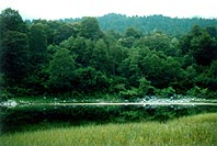
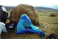
The Lake Devis: tba means lake in Georgian and Devis tba means the
lake of the ogre. It is situated at 1480 m asl in the Radja mountains,
a south-central part of the Great Caucasus. The forest is dominated by
Fagus orientalis, higher up Abies nordmanniana occurs.
|
|
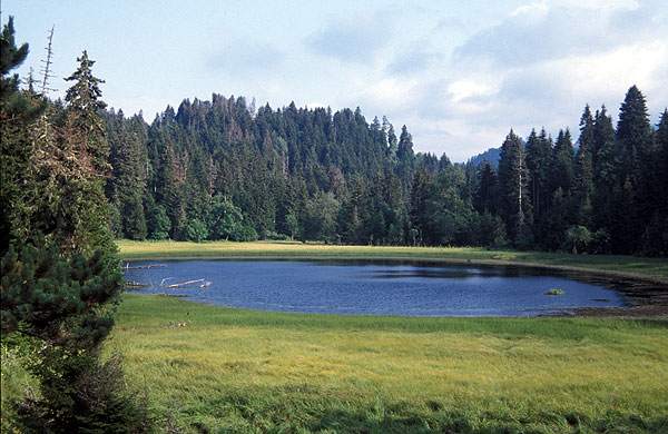
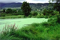
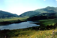
The Lake at Cheliagele is situated at 1100m asl in the foothills of the Great
Caucasus, sw of Amborlauri, ne of Kutaisi. |
 |
|
|
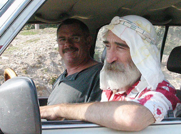
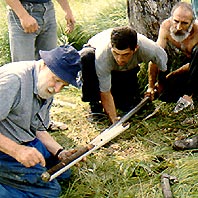
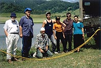
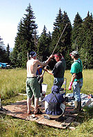
Extrusion of a core from the square-rod piston
corer at Cheliagele: Herb Wright, Vadim Bolotaev, Alan Jussoev,
Zaal Kikodze, Denis Bagiaev – a
good cooperation between Ossetians, Georgians, Americans.
|
|
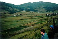
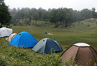
Near Ertso at ca 1800 m asl the large mire was studied by Dr. Nino
Margalitadze. |
 |
|
 |
The Lake Ertso is in a calcareous area but seems to be difficult (krastic?):
mostly shallow and with very little sediment, but with a “swollow hole” of
19 m water depth in the south-west. Coring was not successful; so we preferred
a spring mire nearby that proved to be 3400 radiocarbon years old near its
base. |
|
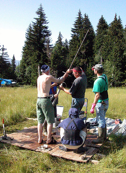
The coring team at Lake Ertso: Herb Wright, DenisBagiaev, Zaal Kikodze, Vadim
Bolotaev, and the family Iliadi with Irakli, Sergio and Nino. |
 |
|
 |
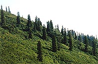
Abies nordmanniana is a beautiful tree on the southern slopes
of the Radja Mountains (Great Caucasus. |
|
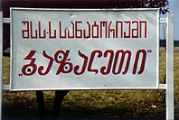
Can you read the name of the lake? You may chose between two types of Georgian
letters: Bazaleti (at ca 900 m asl) – it is a site studied
by Dr. Eliso Kvavadze. |
 |
|
|
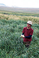
There is wind on the high plateaus of the Caucasus Minor! We tried to core some
steppic lakes e.g. near Tabazkuri –but they are too tough for the hand-coring….we
need to go back with heavier equipment. |
|
|
Field Work, August 5.
- 16. 2003 |
|
|
 |
|
 |
Didadjara,
At 1957 m asl, in the Fagus orientalis forest of Adjara
(41º 41’ 027’’ N / 42º 29’ 818’’ E).
This is a classical site studied by Dr. Nino Margalitadze in the
1960ies)
|
|
Great
helpers on Goderzi-Pass between Meskheti and Adjara: Willi Tanner
and Zaal Kikodze |
 |
|
 |
Gomnis
tba, at 1850 m asl in Meskheti: Trialeti Mountains. The lake is surrounded
by a rich forest dominated by Picea orientalis and Abies nordmanniana |
|
The
Georgian-Swiss-Italian team coring on the Carex lasiocarpa and Molinia
coerulea belt of Gomnis tba |
 |
|
 |
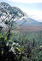
Heracleum
wilhelmsii at Nariani near Tabackuri with the Abuklsamsari in the
background |
|
Imera,,
east of Tsalka, is a site of Simon Connor; here he found Nymphaea
candidissima |
|
|
|
|
Webmaster
|